
AI Floor Plan & LiDAR Scanning App Development
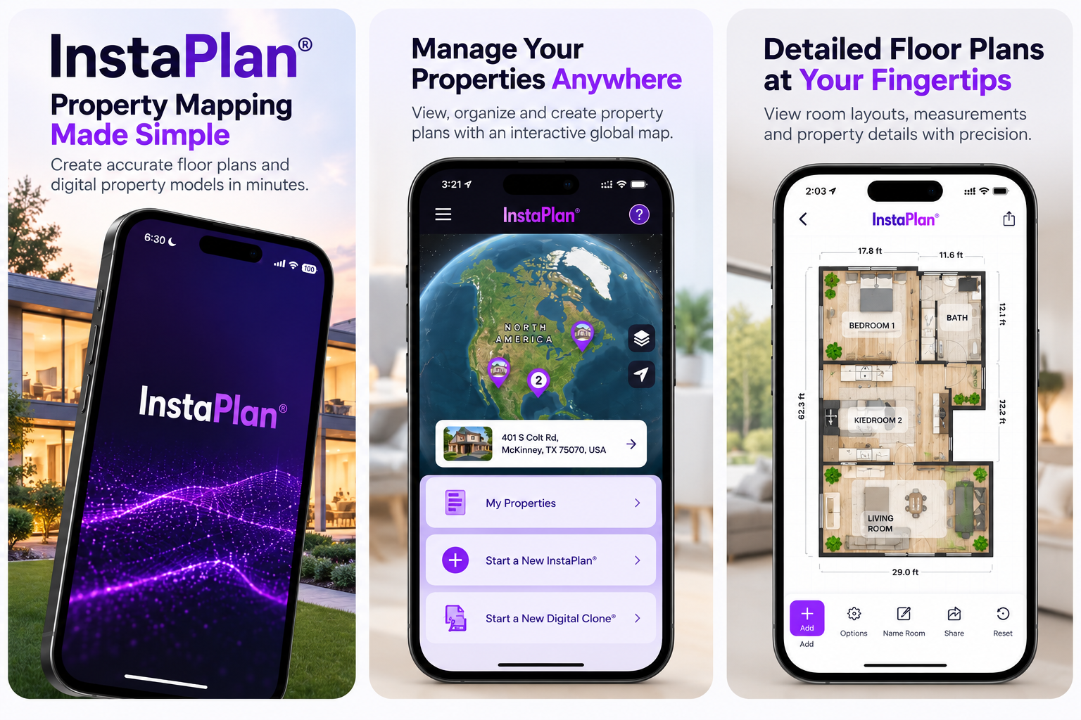
InstaPlan is an AI-powered property scanning application that uses iPhone LiDAR technology to generate accurate, editable floor plans, measure spaces, and simplify property inspections for real estate and construction professionals.
InstaPlan, powered by Makena AI, is an advanced LiDAR-based property scanning and AI floor plan generation mobile application designed to transform how real estate professionals, property inspectors, appraisers, and construction teams capture and manage building measurements. By leveraging Apple's LiDAR scanning technology and intelligent spatial data processing, the application enables users to scan interior spaces and generate detailed, editable floor plans directly from compatible iPhones and iPads. Unlike traditional property measurement methods that rely on manual sketches, tape measures, and external processing, InstaPlan provides a convenient digital solution for capturing room dimensions, identifying architectural layouts, and creating accurate property plans within minutes. The application uses AI-powered room detection, real-time spatial mapping, and automated floor plan generation to identify walls, recognize room boundaries, calculate dimensions, and organize property information. Users can review their floor plans immediately, adjust wall placements, merge scans, and add missing rooms through intuitive editing controls. With its combination of 3D room scanning, digital property measurement, and real estate floor plan software, InstaPlan simplifies on-site property data collection while helping professionals reduce manual work and improve documentation efficiency.
Designed to modernize property inspection and appraisal workflows, InstaPlan combines real-time LiDAR scanning, AI-powered spatial analysis, editable floor plans, and automated property measurement tools within a streamlined iOS application. The platform enables professionals to capture property layouts, calculate gross living area (GLA) and gross internal area (GIA), document room conditions, and organize inspection information through an intuitive mobile interface. Its built-in editing tools allow users to refine scanned measurements, update room details, adjust floor plan layouts, and prepare accurate digital documentation directly at the property. InstaPlan also supports offline property scanning and inspection data collection, helping field professionals continue working in locations with limited internet connectivity. Collected information can be synchronized when connectivity becomes available, improving flexibility for residential appraisals, property inspections, and construction-related assessments. For professional workflows, the application offers PDF floor plan exports, integration with appraisal management systems, and property documentation features aligned with industry reporting requirements. These capabilities help users prepare structured inspection records and share digital property information with relevant stakeholders. InstaPlan demonstrates how custom LiDAR scanning app development, AI-powered real estate applications, 3D property modeling, and PropTech software solutions can modernize traditional property measurement processes. By combining intelligent scanning technology, real-time floor plan editing, and digital property reporting, InstaPlan provides an efficient mobile solution for appraisers, home inspectors, real estate professionals, and construction teams seeking faster, more organized property documentation.


-
Find us
Office no-14, Prosperity Arcade, D-229, Sector 74, Mohali, Punjab-160071
-
Email us
admin@appcodie.com
appcodie@gmail.com
-
Phone support
+ (91) 97798 00512